Flooding's becoming an increasingly common occurrence in the West of England. This time, I've been around to see the Avon break its banks around Bath, and in Bradford-on-Avon. I don't remember this happening last winter, but it may well have happened in the summer - I was conversing with an old man on the bridge in BoA and he said, "It was worse last year" - and it wasn't until later that I remembered the summer floods that happened while we were in the USA. I am a bit concerned about it, because when I moved out to Father Hand's for the year, there was some quite severe flooding (that was in 2000) - perhaps it's my fault.
Anyway, the Avon in BoA had been up to within a foot of the walkway on Tuesday and I persuaded Mr Z to let me borrow his baby on Wednesday so I could take some pictures around Bathford, but then on the way to work I found the water levels in BoA had risen roughly 4 feet and the bridge was nearly flooded, so I got even better pictures than I expected. Ian had picked Wednesday to take year 13 to see the Tithe Barn and the Saxon church, and then arrived back fairly wet after opting to wade through standing water rather than walk up the hill and around the flooding.
 The picket fence marks the usual boundary.
The picket fence marks the usual boundary.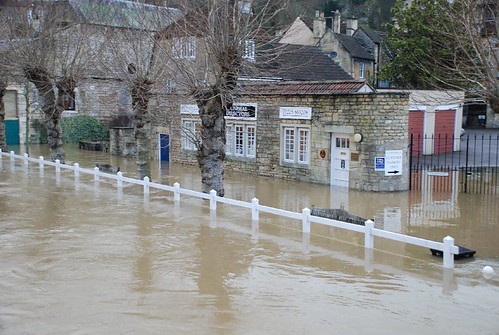
You can see how high the level is by the benches - just the top few inches of them showing, plus that bin is almost underwater.
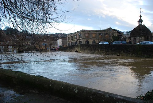
Almost all the arches of the bridge were filled up. On the other side, the water was swirling and sucking through where it was building up a little against the bridge and trying to run through the arches (the water is flowing from right to left in this picture). When the water is at its usual level, the bank runs from the lamp-post on the right to the tree on the left. The level marker on the other side said 29 feet. Scary! Very, very fast-flowing, too.
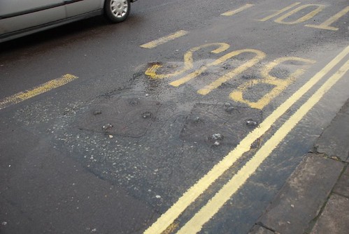

The water pouring up through the drains gave me a clue to why the whole place smelled so bad.
So, that was Bradford on Avon. Thankfully the place seems to be set up for flooding, and only the funeral directors and a couple of riverside pubs seemed affected. I wonder if they coped as well as the Lock and Weir in Hanham - apparently their carpark was underwater (uphill from the pub itself) and they were rowing people to and from the pub; the regulars were all in, sitting around drinking in wellies, in a foot and a half of water.
Further along my route home from work I travel through Bathford, and turn onto the A46, crossing the Avon again. This valley between the BoA road and the A36 was also heavily flooded...
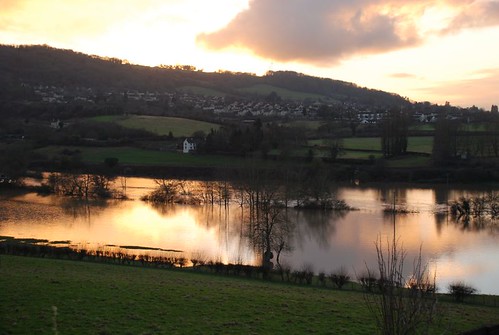
I was very lucky with the light...
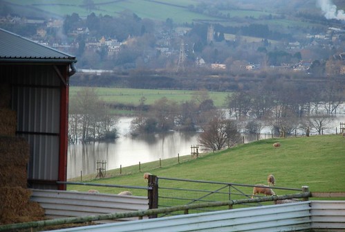 The sheep seemed unconcerned.
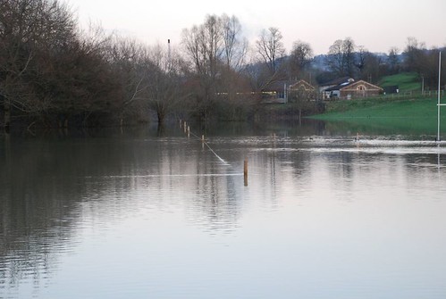 Meanwhile, the ducks (you can see their swim trails to the right) were positively loving it.
You can see, from the tree line, how flooded it really was. The usual span of the river is the other side of the trees - so the flooded portion is the wider strip. It was amazing how much water there was there. Thankfully there are no houses down there so no flooded buildings; and the flooding OUTSIDE Bath meant that INSIDE Bath was alright, I think, so nothing too serious. By the next day, the floods had abated, leaving behind them some very green fields in the valley, and a bit of a mess to sort out at the Bradford on Avon funeral director's.
Thus endeth today's picture-heavy post. Further pictures can be seen in my Flickr stream.
No comments:
Post a Comment